Tracing Kent’s Ancient Ways, from Roman Stone to Sunken Lanes
Today we explore Historic Mapping of Kent’s Ancient Routes: From Roman Roads to Holloways, uncovering lines written by chalk, clay, and centuries of footsteps and wheels. We blend landscape reading with archival sleuthing, practical mapping strategies, and lived stories to reveal how Roman engineering, medieval pilgrimage, market traffic, and patient erosion still shape journeys. Come ready to compare old maps with LIDAR, follow hedgerows hiding deep cuttings, and connect port to market and village to ridge, while sharing your own discoveries with fellow pathfinders.
Across the Chalk of the North Downs
The North Downs carry a terrace of comfortable travel, balancing dryness, visibility, and easy gradients. Here, lines like the later North Downs Way echo much older preferences for high ground safely above flood and mud. Pilgrims and traders found security along the scarp, navigating by church towers, copses, and distant beacons. Contour-hugging tracks conserve energy across miles, explaining why parallel lanes appear like ripples, switching height only to reach for springs, passes, or kinder crossings.
Greensand, Clay, and the Making of Sunken Passages
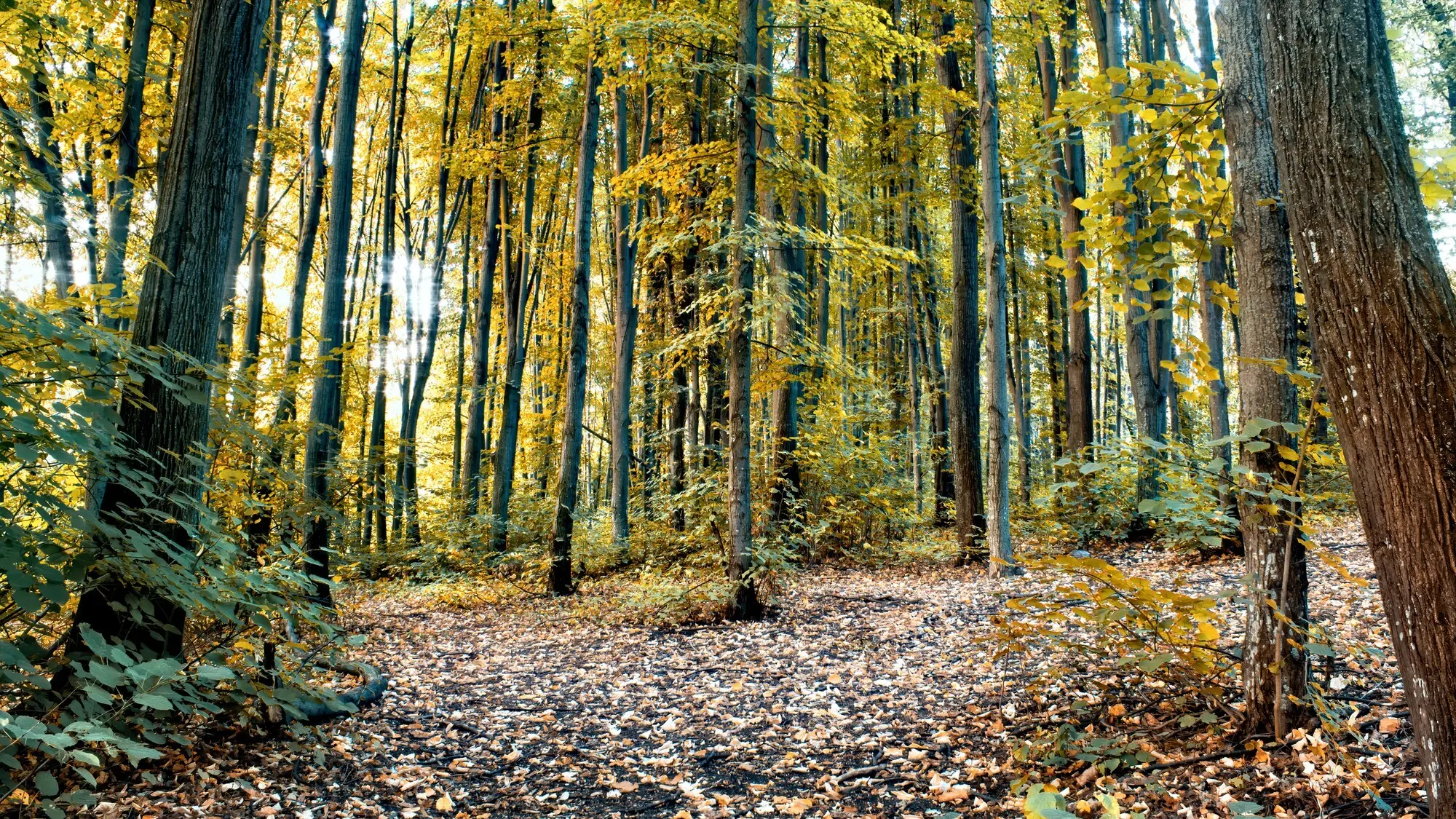
Where wheels grind on clay and rain funnels between banks, each journey deepens a cut. Over centuries, hedged lanes drop until banks rise like green walls, roots revealed, sunlight stitched with ivy and fern. On the Wealden clays and along greensand edges, the interplay of traffic, livestock hooves, and stormwater scours the bed, creating hushed corridors. These holloways record direction and persistence as faithfully as any inscription, whispering of cart-ruts, seasonal drift, and human stubbornness meeting geology.

Watling Street’s Enduring Line
From Dover through Canterbury and Rochester toward London, Watling Street holds a persuasive straightness that modern roads continue to respect. Seek raised aggers, ruler-straight hedgelines, and unnaturally consistent bearings across fields. Diversions often signal later drainage or enclosure rather than original intent. Milestones vanished, but parishes remember. Compare early Ordnance Survey sheets with LIDAR to pick out subtle cambers. Walk a stretch and feel the engineering underfoot: layers of stone still telegraphing a will to connect coast and capital.

Stone Street to Portus Lemanis
Running from Canterbury to Lympne’s ancient harbor, Stone Street illustrates practical compromise between geometry and ground. It selects firm soils, gentle grades, and advantageous spurs to reach the Channel fringe. Along its course, you can read centuries of maintenance, erosion, and reuse, where farms absorbed flanks and hedges reinterpreted width. Near Lympne’s escarpment the view opens, reminding travelers why ports mattered: ships, customs, soldiers, and ideas arriving with tides, then spilling inland along a deliberately strengthened spine.
Pilgrims, Traders, and Drovers on the Move
After legions, faith and commerce redrew priorities. Pilgrims sought Canterbury’s shrine along forgiving contours and sociable ridges, while drovers moved sheep and cattle toward fairs and London markets on durable, grazable lines. Inns, churches, and green lanes stitched hospitality to practicality, creating repeatable days’ journeys. Disputed names or romantic labels matter less than performance: dryness, wayfinding, and kindness to tired feet. Reading this human calculus clarifies why certain lanes deepened, others faded, and some reappeared with seasonal urgency.

Following the Contour: The So-Called Pilgrims’ Way
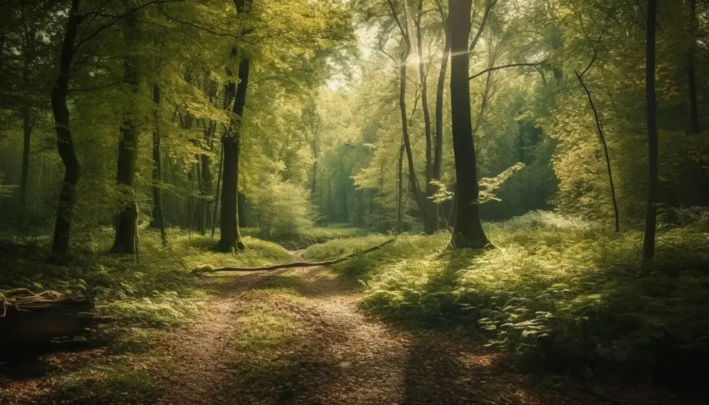
Whether medieval reality or later invention as a single continuous line, the contour route along the North Downs expresses timeless logic. It threads firm chalk, sidesteps sticky clay, and keeps generous sightlines to towers guiding travelers. Waypoints—springs, inns, and safe descents—repeat at humane intervals. Walk it slowly, noticing how the ridge edits weather and mood, then compare parallel traces below and above. Mapping here is also listening: to bells, wind on escarpments, and the comforting predictability of repeatable shelter.

Sheep, Cattle, and the Slow Economy of Distance
Droving demanded grass verges, water, and negotiated rights, shaping lanes broad enough for restless herds. Kent’s flocks, marsh pastures, and wooded commons produced paths tolerant of hooves and season. Look for generous green margins, multiple braided tracks, and commons anchoring overnight halts. Markets drew everything toward weighbridges and tolls, then outward again. Recording these signs helps reconstruct a logistics web built from patience, bargaining, and weather sense, long before wagons surrendered to hard macadam or iron rails.
How to Map What Time Tried to Hide
Evidence survives in patterns. LIDAR lifts canopies to show banks and aggers; tithe and estate maps preserve pre-enclosure drift; early Ordnance Survey captures lanes since gated. Pair these with fieldwork, photographs, and toponyms to build persuasive cases. Document your reasoning, not just your lines, so others can replicate and challenge. The goal is collegial discovery: converging proofs from landscape, archive, and lived experience producing maps that are transparent, adaptable, and generous to future walkers and researchers.

Stories the Lanes Still Whisper
A Winter Descent into a Wealden Holloway
Frost stitched the banks with lace and kept the clay polite for twenty careful minutes. A rook lifted, the lane dipped, and boot soles found grooves older than our names. At the bend, a spring murmured under fern, and an ash root bridged the cut like a practiced hand. Back home, the track matched LIDAR perfectly, but the cold on fingers told the fuller truth we mapped in grateful, shivery ink.
Mail Coaches on the Ridge near Charing
A veteran walker remembered his grandfather’s tale: lamps rocking, horns slicing fog, hooves striking the chalk with urgent purpose on nights when the ridge wore a rim of frost. The modern road now hurries beside the old line, yet on quiet evenings a wind eddy mimics harness jangle. Recording such recollections beside coordinates gives weight to suspect alignments, letting folklore and survey cooperate rather than quarrel in the margins of our notes.
A Sunken Track Through Blean’s Dappled Shade
Under chestnut and beech, the lane fell away into coolness where thrushes worked anvils of snail shell. Nettles tilted like spectators at a village match. A bicycle bell far above reminded us a newer world skimmed nearby. GPS drifted, but the trench remained certain as a scar. We paced, sketched, then asked a woodman who named the farm boy shortcut his grandmother used, closing the loop between memory, bark, and map.
Walk Kindly: Gates, Dogs, Crops, and Courtesy
Ancient does not mean fragile beyond use; it means deserving of thoughtful tread. Close gates, respect stock, and give wide berth to crops pushing through soil that once bred ruts. Keep dogs leashed near lambing and ground-nesting birds. Step aside for horses where banks restrict passing. Report fallen branches and pooling water to the parish or council. Courtesy is continuity: each considerate choice keeps a path open for the next traveler reading the same bend.
Volunteer Power: Recording, Drainage, Small Repairs
A spade and notebook can rescue a lane. Photograph eroding beds, clear blocked grips, and nudge debris from culverts before winter soaks bite. Share findings with the Kent Historic Environment Record and local path wardens, adding coordinates and context. Hedge laying workshops, stile checks, and waymark refreshes transform complaints into camaraderie. Repair is mapping’s companion: each act teaches how water behaves, how banks collapse, and how tiny attentions prolong centuries of shared, resilient passage.
All Rights Reserved.